CLAREMONT, Calif., April 15, 2020 (SEND2PRESS NEWSWIRE) — NAG, Inc. has developed a web solution that will improve the management of coronavirus. The application will have widespread impact on restricting spread of the virus mainly due to narrowing lockdown measures to focus on specific impacted areas which account for a fraction of each jurisdiction, leaving most of the jurisdiction’s citizens and economy to function normally.


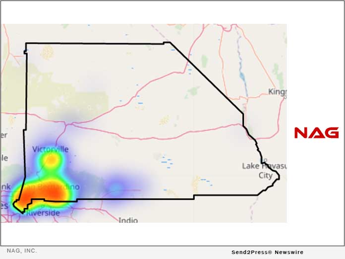
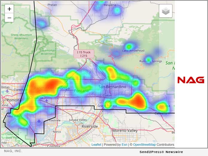
IMAGE CAPTION: For illustration only – simulated mathematical modeling of areas under threat comprising approximately 10% of a County’s jurisdiction.
The world is on lockdown, resulting in the mass incarceration of people in home confinement and completely shutting down the economy, resulting in what is likely to be a global recession. These measures are a gut reaction to panic about the virus, and not a studied decision based on real and evolving information.
These widespread global measures covering entire jurisdictions (ignoring actual pockets of infection) are extremely inefficient, wasting scarce resources and destroying the economy.
Scientific analysis starts by investigating individual cases of infection to determine the extent of actual spread, then gradually widening the net to include all areas under real threat of infection spread. Narrowing the problem to precisely those areas that need focused attention achieves the most efficient and productive allocation of resources. This avoids a diffused response over large areas that may not need any intervention at all.
Mathematical models input point data, for example geolocated cases of confirmed infection determined by RNA tests. These, along with patient contact tracing, allow us to precisely identify areas directly under threat. In the absence of widespread testing (as is the case in the U.S.), NAG conducts household surveys to broaden the scope of detection of the virus.
Implementing these procedures continuously in real time, changes in the progress of the disease can be tracked as the situation evolves over time.
Scarce resources can then be focused on solving the problem within these finite areas instead of being wasted on areas not under threat. For example, Personal Protective Equipment (PPE) supplies would be more than adequate to meet the needs of hospitals located within an area under threat (colored in red, yellow, green and blue on the maps) if they are not wasted on uninfected areas. All of the uncolored areas on the map can revert back to normal, avoiding lockdown and closure of businesses. If a new case is detected, it will immediately appear as infected on the map, and can be treated accordingly. Data is updated in real time as information changes with the evolving situation.

About NAG, Inc.
Founded in 1991, NAG, Inc. is a technology-consulting firm specialized in data visualization solutions to federal, state, regional and local government agencies in space exploration, transportation, administrative services, economic development, community development, public utilities and public safety. NAG leverages the latest real-time sharing technologies to process complex data and improve the speed, access, accuracy and overall management of data.
Learn more at: http://nagincorporated.com
IMAGE links for media:
[1] https://www.Send2Press.com/300dpi/20-0414s2p-nag-inc-Annotation01-300dpi.jpg
[2] https://www.Send2Press.com/300dpi/20-0414s2p-nag-inc-Annotation02-300dpi.jpg
Caption: For illustration only – simulated mathematical modeling of areas under threat comprising approximately 10% of a County’s jurisdiction.
[3] https://www.Send2Press.com/300dpi/20-0414s2p-nag-inc-logo-300dpi.jpg
News Source: NAG Inc